Archive for the ‘Pensacola Aerial’ Category
Random Images ….
Here are several images that I might or might not have posted before. The first one of the ribbon cutting at the Bay Bridge entrance is new, I believe. The rest I might have posted along time ago, but I had just run across them again and thought that I might post them again. Here we go …
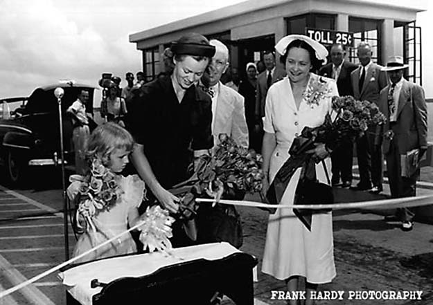
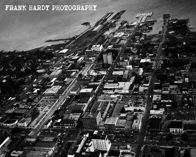

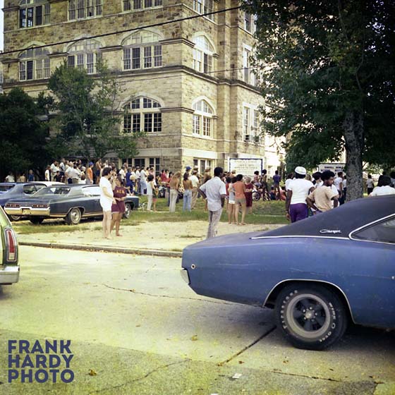
The top photo of the ribbon cutting is new and if anyone recognizes any of the people, please comment. I have no clue who any of the people are, as usual, but I am interested in knowing who they are. The aerial photo was taken before the Municipal Auditorium was constructed, so that must have been around 1954 or so. I think that the auditorium was completed in 1955, but that is just a guess for me. This Dons group was 1959 I believe…how about that Hopkins Boarding Sign on the the back fence wall? If anyone knows anything about any of these photos, please comment. Thanks for looking and please check back … Frank
Pensacola Pier ….
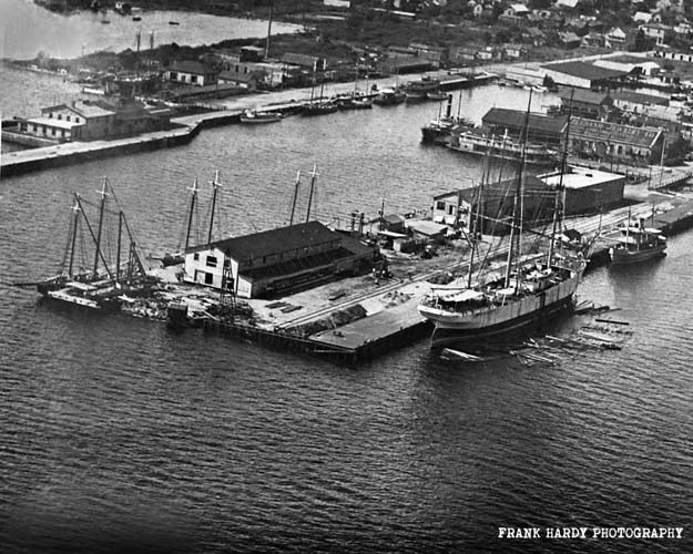
I ran across this negative years ago and just set it aside. Someone had brought me this print to copy back in the 1980’s and I made me an extra copy. This is the end of Palafox Street and I want to say that this is taken in the 1930’s. The strip of land on the back side would be where the Port Royal Development is built today. No idea who took the photo, but if anyone has any information on this image, please feel free to comment and share anything that you might know. Thanks for looking and please check back. One of my New Year’s resolutions for 2017 is to try and post several times a month. I have been busy with other ways to share my photography ( Instagram is the main one ) and have sort of ignored my two blogs. But no worry, I still have thousands of images to work through and post, so don’t give up on me yet.
Twelfth Avenue Fire …
On Sunday August 17, 1975, a fire destroyed this entire block. It was a Sunday morning around 11:00 when it started in the freezer of Exotic Florist. There was an electrical short in the wiring of the freezer that held Exotic’s flowers. This building was built sometime in the early 1950’s and the building code did not require fire walls between the offices … since there was no fire wall, all of the units shared a common attic. Once the fire got into the attic, it was just a short time until all of the businesses where consumed in fire. My father happened to be there at the time and was able to grab a few cameras and save them, but everything else in his studio was completely destroyed. The following is a photographic story of the fire, the aftermath and the rebuilding of the block. There are a lot of photos and they really need no explanation, so I won’t bother you with any …


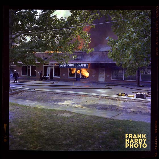


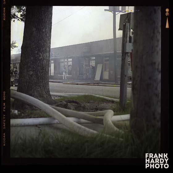


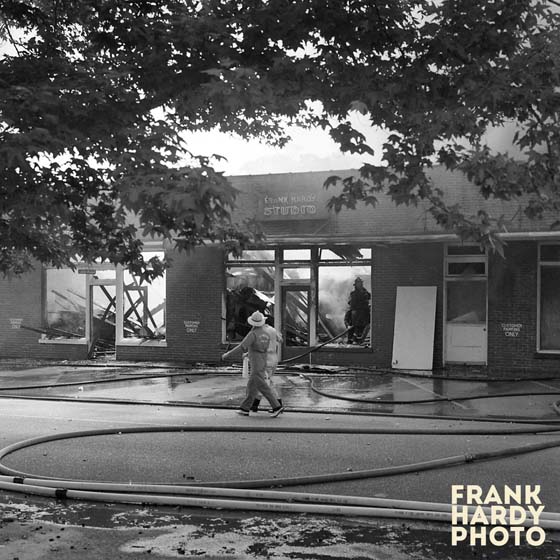
I tried to enter the photographs in some type of sequence starting down at Exotic Florist and then moving north up 12th Avenue through the rest of the businesses. The entire fire from start to finish only took an hour or so. The firemen did an excellent job in getting the fire out and luckily they were able to save the Winn-Dixie grocery store. Now the next photograph is the clean-up several days later …

There was an alley between the grocery store and the building that burned, so I am sure that was the reason that Winn-Dixie did not burn. But it did have smoke and some water damage. The above photo was taken the following week and I am not sure of the date. The Moulton’s owned the property and cleaned up the damage within a week or so. Now, the next images are of the new building that was built within six months of the fire …


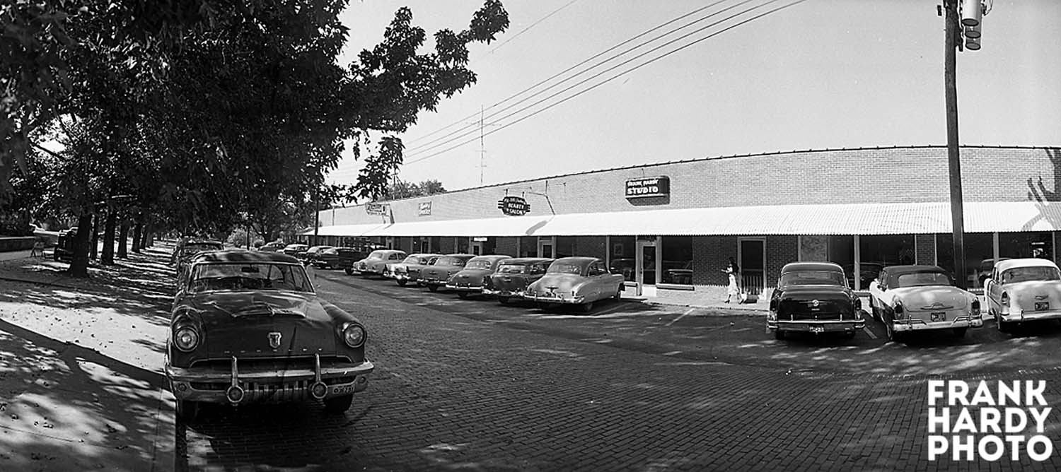
The aerial photograph is one that I made years later, but I thought that it added something to the rest of the images. The only businesses that went back in were Dr. Hoyt, Fischler Framing and my father. This new building was completed by February 1976. He had moved across the street to a vacant building on Gonzalez Street and this is where he had started his business in 1948. There are several other photos that I might throw up later, but this is the majority of the images that I have collected / found through the years. The Pensacola News Journal did an article on my father and the fire, but I do not know if I am allowed to publish the photos and the write-up, with copyright laws and such. Speaking of which, there is a local hospital that has been using my photos in their centennial advertisements without my permission or compensation, but that is a whole other story. Thanks for looking and please check back. Also, if anyone remembers the fire and happened to around when the fire started, I would like to hear from you … Frank. I will leave you with one more view across the parking lot looking North.

Cordova Park Aerial …

This aerial was made back in 1959 … the roads were still dirt at this time. I identified Bayou Blvd and also Dunwoody Drive to help orient you. The ” Round-House ” in the bottom of the frame is featured in a prior post where my father had used a Wide-Lux Panorama Camera. This is a new photo that I ran across several months back and was not posted on the old site. To the right of the lettering ” Bayou Blvd ” is where Trinity Presbyterian is located today. Thanks for looking …
Borden’s Dairy …

This is the Borden’s Dairy plant that was located on Davis Highway, just south of Fairfield Drive. On the old site, this photo and the aerial of this plant that I am going to post next, were two separate posts, but I just decided to combine the two. The plant above is pretty much a straight commercial shot of the building itself … the aerial that I am going to post is interesting in that it was before the I-110 spur was built. Here is the aerial view of the Borden’s plan:

Notice how Fairfield Drive was just a two lane road, and I believe that back in the 1950’s when this photograph was taken it was called ” Pottery Plant Road “. You also see the drive-in that was located next to the plant. I do not remember the name of the drive-in so if anyone does, let us know the name. The school in back of the plant is still there and I believe that it is Brown-Barge Elementary, but please correct me if I am wrong. The houses across the street are all still there today. Remember that all comments are welcomed … thanks for looking.
Old Sacred Heart Hospital Aerial …

This aerial shows the old Sacred Heart Hospital and the Sacred Heart Nurse’s Home on 12th Avenue. To the north of the hospital is the building that once housed Friendly Service Grocery, Moulton’s Drug Store and a series of offices. One of these offices on Gonzalez Street was my father’s first photography studio. Also, notice that there is no office building across from the hospital. My father must have made this photo sometime in the late 1940’s.
Port of Pensacola …

I ran across this aerial a year or so back, but never wanted to spend the time to clean it up. It is an interesting view of the Port of Pensacola because it is shot from the east looking back to the west. Most of the aerial views that I have posted before always seemed to be looking north up Palafox or from the west looking back to the east. You even have a decent view of Seville Square, even though it looks to be all trees and not much of a park. I have no date for this image, but I would say early 1950’s. Anyone know a date, please speak out …
Aerial over Twelfth Avenue Bridge …

The plane is over Carpenter’s Creek in this image. The road going into Pine Glade’s is a dirt road and no homes have been built yet. You see Cordova Park on the other side of the Twelfth Avenue Street Bridge and it looks as if Dunwoody coming off of 12th is a dirt road. Also, there are no houses on Bayou Texar in this view. I am not sure of the year that this photo was made … if I had to guess it would be the early 1950’s, maybe 1951 or 52. I have 10 or so aerials of Cordova Park my father made around this time to around 1961 that I plan to post in the future.

You must be logged in to post a comment.